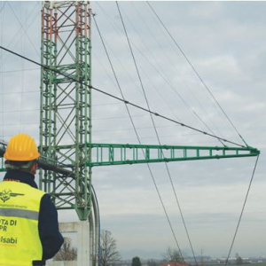
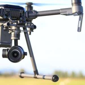
Italsabi is an RPAS operator recognized by ENAC, aut. N ° 45833 -25782 for the use of RPAS also in specialized operations critical scenarios S02 / S04 / S06
All our APR pilots are qualified by ENAC and supported by ISO 9712 level II qualified observers for Visual and Thermographic Control
Some fields of application of the service are:
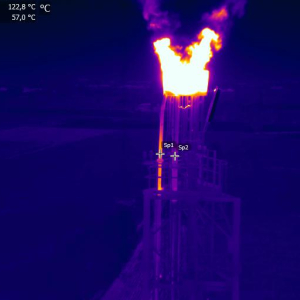
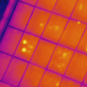
AERIAL THERMOGRAPHY ON PHOTOVOLTAIC PARKS WITH DRONE
Aerial thermography is part of the scheduled maintenance plan for photovoltaic systems in the renewable energy sector.
With aerial thermography using Drone it is possible to identify "hot-spots", short-circuited cells, defective bypass diode, general connection problems.
Italsabi operates according to the IEC TS 62446-3 Standard, certifying the control of photovoltaic systems with ISO 9712 II Level technicians
VISUAL AND THERMOGRAPHIC CHECK ON BRIDGES, VIADUCTS AND WALKWAYS
Visual investigations with extension of the method on Bridges, Viaducts and Walkways (VT - INF) with Bureau Veritas Civil Sector Level II operators - approved by ACCREDIA
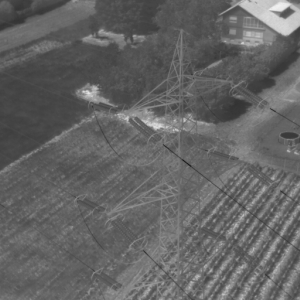
VISUAL AND THERMOGRAPHIC CONTROL IN WIND POWER PLANTS
Verification of the state of the art of:
Tower
Spacecraft
Wind turbines
DAMS INSPECTION
Visual and thermographic checks on penstocks
Visual and Thermographic Inspection of the dam faces
Crack mapping of the vestments
Video Inspection of the banks of the basin
Photogrammetric survey for point cloud reconstruction of the dam.
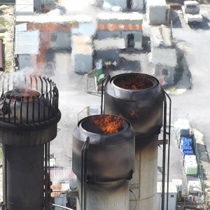
NON DESTRUCTIVE CHECKS WITH SAPR SYSTEM
Visual and Thermographic Control with DRONE (VT and TIR) on:
Petrochemical plants
Power and hydroelectric power stations
Wind farms
Refineries
Offshore plants
River pipelines
Atmospheric reservoir parks
Photovoltaic parks
Insulated lines
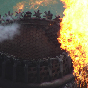
Flare tip
AEROPHOTOGRAMMETRIC AND GPS SURVEYS WITH DRONE AT QUARRIES AND LANDFILLS
It is possible to carry out aerial photogrammetric surveys with references to the ground using precision GPS, which can be used for the reconstruction of digital terrain models, the calculation of the volumes extracted for the declarations to the relevant Municipality or as a fulfillment of the new regional law 03/16/2018 n 13, art. 20 "Statistical communications and data on quarry activities".
Through targeted flights with drone authorized and registered with ENAC with N ° APR 15762 -19798 it is possible not only to carry out photogrammetric surveys but also to verify the state of affairs of areas before opening a construction site, monitor the state of crops, perimeter the landslide areas o access inaccessible places with shooting points that are often decisive for understanding the phenomena in progress
With the use of the Leonardo XE software, it is possible, thanks to the special advanced modeling functions, to perform the feasibility study of a quarry or landfill, complete with calculation of the volumes involved for the consequent evaluation of costs.
Italsabi guarantees the maximum protection of sensitive customer and third party data guaranteed
Discover all our services with the drone at the following link:
droneitalsabi.it